Passer au contenu principal
abebooks.fr
Chercher
Ouvrir une session
Votre compte
Panier
Aide
Menu
Votre compte
Vos commandes
Recherche avancée
Collections
Livres anciens
Art & Collection
Vendeurs
Devenir vendeur
Aide
Fermer
×
Modifier la devise
Sélectionnez votre devise
Dollar australien - A$, AUD
Dollar canadien - C$, CAD
Dollar US - US$, USD
Euro - EUR
Livre sterling - £, GBP
Baht thaïlandais - THB
Couronne danoise - DKK
Couronne islandaise - ISK
Couronne norvégienne - NOK
Couronne suédoise - K, SEK
Couronne tchèque - CZK
Dinar algérien - DZD
Dinar jordanien - JOD
Dollar bahaméen - BSD
Dollar de la Barbade - BBD
Dollar de Singapour - S$, SGD
Dollar de Trinité-et-Tobago - TTD
Dollar des Caraïbes Orientales - XCD
Dollar fidjien - FJD
Dollar hong-kongais - HKD
Dollar jamaïcain - JMD
Dollar néo-zélandais - NZ$, NZD
Dollar taïwainais - TWD
Droit de Tirage Spécial - XDR
Forint hongrois - HUF
Franc suisse - CHF
Leu roumain - RON
Livre libanaise - LBP
Livre égyptienne - EGP
Nouveau shekel israélien - ILS
Peso argentinien - ARS
Peso chilien - CLP
Peso mexicain - MXN
Peso philippin - Phi, PHP
Rand sud-africain - R, ZAR
Ringgit malaisien - MYR
Riyal saoudien - SAR
Rouble russe - RUB
Roupie indienne - Rup, INR
Roupie indonésienne - IDR
Roupie pakistanaise - PKR
Réal brésilien - Real, BRL
Won sud-coréen - Won, KRW
Yan Renmimbi Chinois - CNY
Yen - ¥, JPY
Zloty polonais - PLN
Maps & Atlases
Proposé par
Bow Windows Bookshop (ABA, ILAB)
Plus populaires
Ajouts récents
Prix croissant
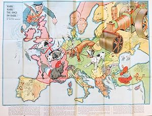
Hark! Hark! The Dogs do Bark! With Note by Walter Emanuel
JOHNSON, RIDDLE & CO, LTD.
1914
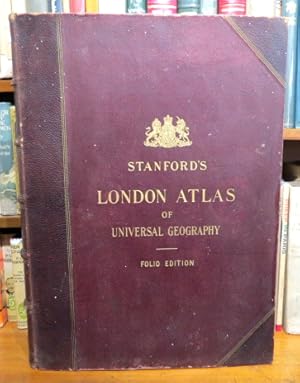
Stanford's London Atlas of Universal Geography. Exhibiting the Physical and Political Divisions o...
STANFORD
1904
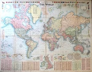
Bacon's New Chart of the World. Mercator's Projection
BACON, G.W.
1906
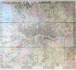
Cruchley's New Plan of London and its Environs
CRUCHLEY, [George Frederick]
1830
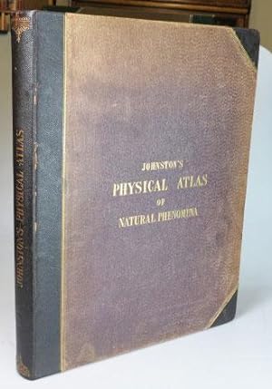
The Physical Atlas of Natural Phenomena
JOHNSTON, Alexander Keith
1850
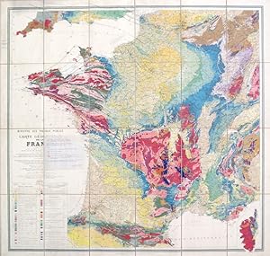
Carte Géologique de la France.
MICHEL-LÉVY, M. Albert
1905
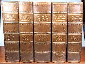
The Universal Pronouncing Dictionary, and General Expositor of the English Language:. Embellished...
WRIGHT, Thomas
1852
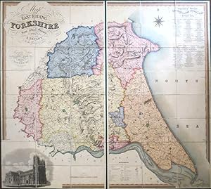
Map of the East Riding of Yorkshire from Actual Survey by. In the Years 1827 & 1828
BRYANT, A.
1829
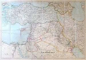
Stanford's Map of the Middle East
STANFORD'S
1933
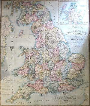
Map of the Inland Navigation, Canals, and Rail Roads with the Situations of the Various Mineral P...
WALKER, J.
1830
G. Bradshaw's Map of Canals Situated in the Counties of Lancaster, York, Derby & Chester; Shewing...
BRADSHAW, [George]
1830
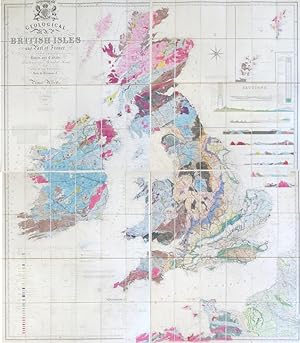
Geological Map of the British Isles and Part of France. Showing also the Inland Navigation by Mea...
KNIPE, I.A. [James Alexander]
1854
New Dissected Map of England [and Wales]
(JIGSAW)
1840
The Making of the Nuremberg Chronicle. [By.] Assisted by Joyce Lancaster Wilson. Introduction by ...
WILSON, Adrian
1978
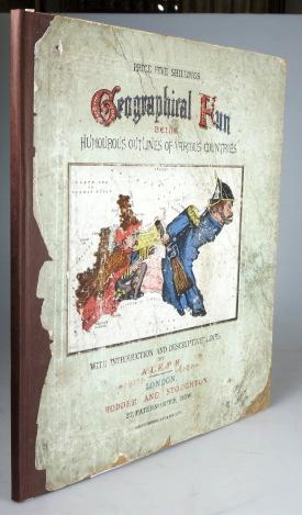
Geographical Fun: Being Humorous Outlines of Various Countries with an Introduction and Descripti...
"ALEPH". [HARVEY, William Henry]
1868
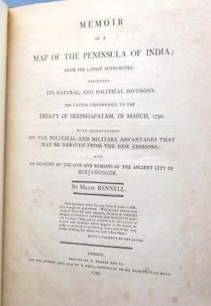
Memoir of the Map of the Peninsula of India; From the Latest Authorities; Exhibiting its Natural,...
RENNELL, Major [James]
1793
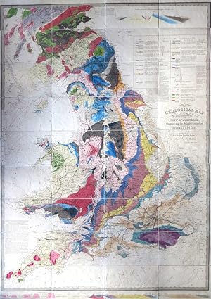
A Geological Map of England & Wales, and Part of Scotland, Showing also the Inland Navigation by ...
WALKER, J. & C. [& KNIPE, J.A.]
1837
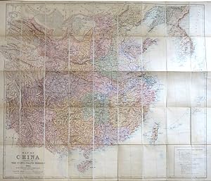
Map of China Prepared for the Inland Mission 1905
BRETSCHNEIDER, E. [in association with] STANFORD, Edward
1905
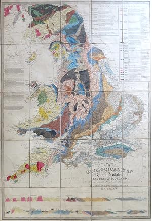
A Geological Map of England, Wales, and Part of Scotland, Showing also the Inland Navigation with...
WALKER, J. & C. [& KNIPE, J.A.]
1838
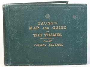
Taunt's Map of the River Thames from Oxford to London, (Pocket Edition). The Maps are Reduced fro...
TAUNT, Henry W.
1882
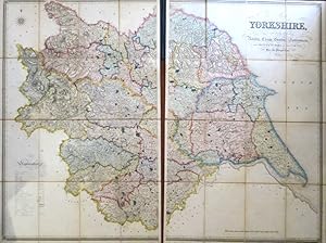
This Map of Yorkshire is Most Respectfully Dedicated to the Nobility, Clergy, Gentry, Landowners ...
HOBSON, William Colling
1843
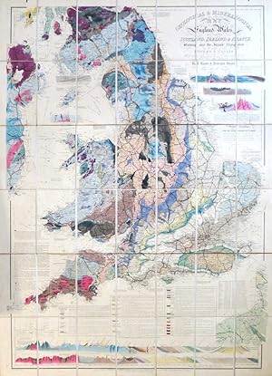
Geological & Mineralogical Map of England & Wales, With Parts of Scotland, Ireland & France, Show...
KNIPE, J.A.
1854
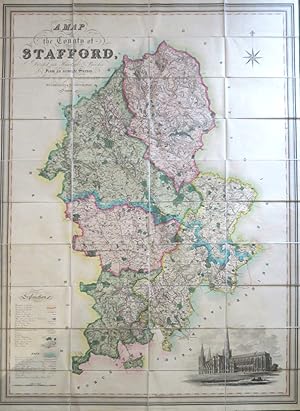
A Map of the County of Stafford Divided into Hundreds & Parishes, From an Accurate Survey, Made i...
PHILLIPS, J. and HUTCHINGS, W.F.
1832
The Scripture Atlas; or, a Series of Maps, to Illustrate the Old and New Testament: Drawn from th...
MURPHY, William
1830
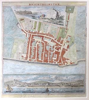
Brighthelmston
YEAKELL, [T]. and GARDNER, [W]
1830
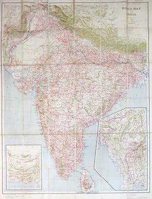
Road Map of India
SURVEY OF INDIA
1943
Mogg's New Plan of London
MOGG, E.
1838
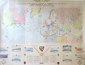
Dunkirk to Berlin June,1940 - July, 1946. Journeys Undertaken by the Rt. Honble. Winston S. Churc...
(CHURCHILL, Winston S.)
1947
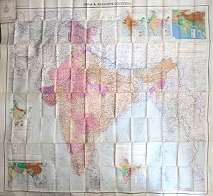
India and Adjacent Countries
SURVEY OF INDIA
1952
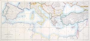
Stanford's Map of the Mediterranean Sea
STANFORD, Edward, Ltd
1923
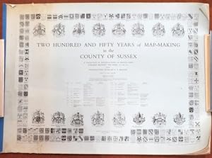
Two Hundred and Fifty Years of Map-Making in the County of Sussex. A Collection of Reproductions ...
MARGARY, Harry (Editor)
1970
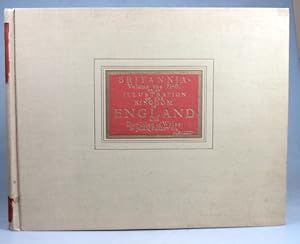
Britannia, Volume the First: or, an Illustration of the Kingdom of England and Dominion of Wales....
OGILBY, John
1939
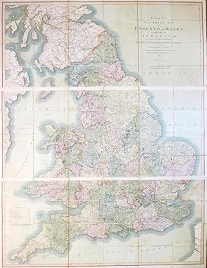
Cary's Six Sheet Map of England and Wales, with Part of Scotland: on which are Carefully Laid Dow...
CARY, J.
1826
[Mayfair and South Marylebone]
ORDNANCE SURVEY
1872
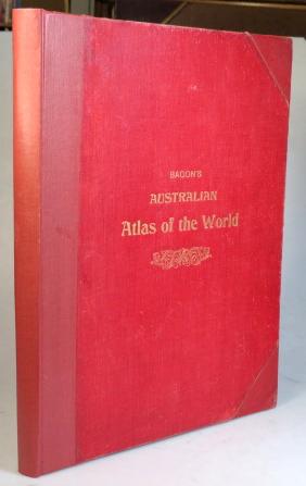
Bacon's Australian Atlas of the World. Containing. Maps, Letterpress Descriptions, Gazetter and I...
BACON, G.W.
1910
The American Atlas 1776. [Second title, copying the original] The American Atlas: or, a Geographi...
JEFFERYS, Thomas
1976
London and its Environs (Reduced from the Skeleton Plans)
(ORDNANCE SURVEY) [under the direction of] YOLLAND, Captain
1851
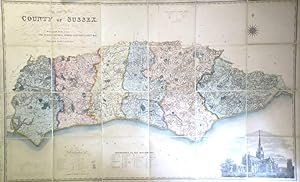
Map of the County of Sussex from an Actual Survey Made in the Years 1823 & 1824 Corrected to the ...
[GREENWOOD, C. & J.] FIGG, William
1861
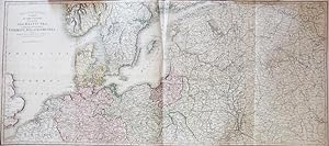
Theatre of War. A Map of the Country Surrounding the Baltic Sea, Comprehending the Northern Part ...
SMITH, C.
1812
[Collection of Six Folding Maps]: The World on Mercator's Projection. [with] Map Exhibiting the N...
HALL, S. & WALKER, J.
1840
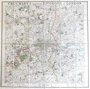
Cruchley's Improved Environs of London
CRUCHLEY, G.F.
1830
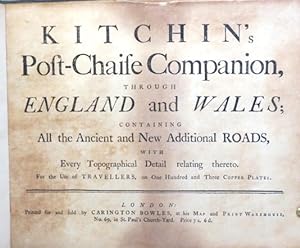
Kitchin's Post-Chaise Companion, through England and Wales; Containing All the Ancient and New Ad...
KITCHIN, Thomas
1770
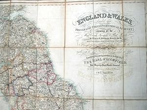
England and Wales founded upon The Grand Trigonometrical Survey; shewing all the Mail Coach, Turn...
WALKER, J. and C.
1840
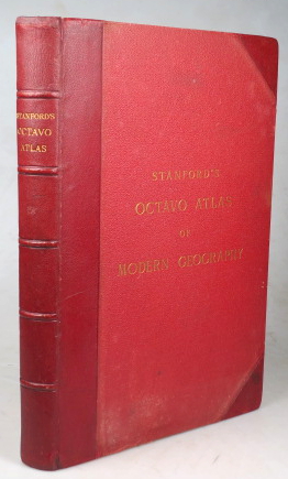
Stanford's Octavo Atlas of Modern Geography
(ATLAS)
1896
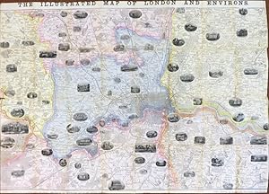
The Illustrated Map of London and Environs
[DOWER, John]
1857
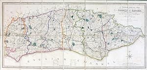
A Topographical Map of the County of Sussex; Reduced from the Large Survey in Four Sheets by.
GREAM, Thomas
1844
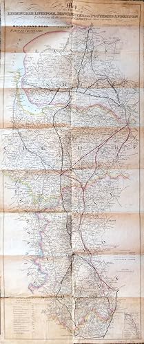
Map of the Environs of Birmingham, Liverpool, Manchester, the Potteries & Preston Exhibiting All ...
MOGG, E.
1839
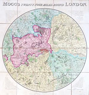
Mogg's Twenty Four Miles Round London
MOGG, Edward
1809
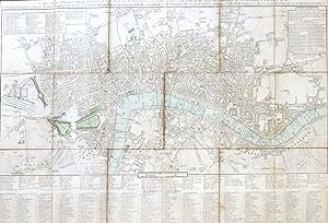
Cary's New Pocket Plan of London, Westminster and Southwark:.
CARY, J.
1797
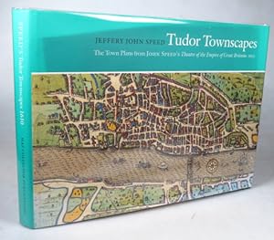
Tudor Townscapes. The Town Plans from John Speed's Theatre of the Empire of Great Britaine 1610. ...
SPEED, Jeffrey John
2000
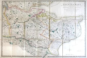
A Map of the County of Kent Drawn from the Topographical Survey Taken, by Order of the Honourable...
(ORDNANCE SURVEY) [under the direction of] MUDGE, Wm., Lt...
1841
Johnstons' Atlas of the War 1855. [Comprising]: Johnston's New Map of the Seat of War in the Danu...
JOHNSTON, W. & A.K.
1855
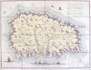
Geographical Plan of the Island and Forts of Saint Helena.
READ, Lieut. R.P.
1815
Cruchley's Railway and Excursion Map 24 Miles Round London
CRUCHLEY, G.F.
1857
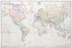
Laurie's Chart of the World on Mercator's Projection. (Reduced from the Large Chart by John Purdy)
LAURIE, Richard Holmes
1857
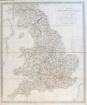
New and Improved Map of England and Wales, Including the Principal Part of Scotland whereon are C...
GARDNER, W.R.
1825
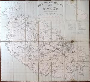
Map of the Island of Malta. Prepared in the Royal Engineers Office, Malta
ROYAL ENGINEERS
1910
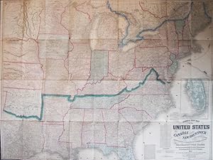
Lloyd's New Map of the United States, the Canadas and New Brunswick. From the Latest Surveys Show...
LLOYD, J.T.
1863
Plus de résultats

![New Dissected Map of England [and Wales]](http://pictures.abebooks.com/inventory/md/md31129871229.jpg)
![The Making of the Nuremberg Chronicle. [By.] Assisted by Joyce Lancaster Wilson. Introduction by ...](http://pictures.abebooks.com/inventory/md/md31805201498.jpg)

![[Mayfair and South Marylebone]](http://pictures.abebooks.com/inventory/md/md30224614287.jpg)
![The American Atlas 1776. [Second title, copying the original] The American Atlas: or, a Geographi...](http://pictures.abebooks.com/inventory/md/md30809268506.jpg)
![[Collection of Six Folding Maps]: The World on Mercator's Projection. [with] Map Exhibiting the N...](http://pictures.abebooks.com/inventory/md/md12512023915.jpg)
![Johnstons' Atlas of the War 1855. [Comprising]: Johnston's New Map of the Seat of War in the Danu...](http://pictures.abebooks.com/inventory/md/md21841880623.jpg)